The Roman Road
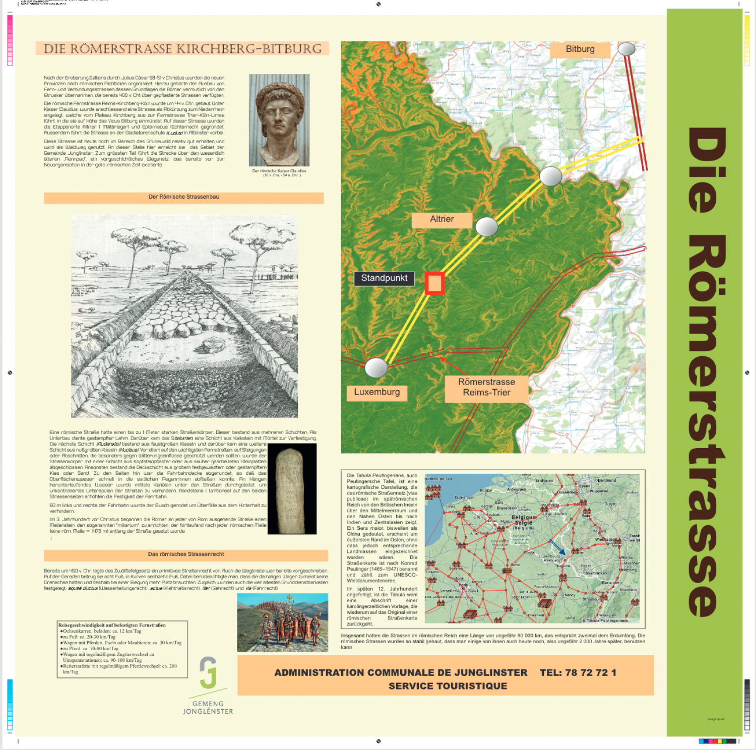
After Gaul was conquered by Julius Caesar in 58-51 BCE, the new provinces were organized according to Roman guidelines. This included the construction of long-distance roads, the principles of which the Romans likely adopted from the Etruscans, who already possessed paved roads by 400 BCE. The Roman long-distance road Reims-Kirchberg-Cologne was built around the year 44 BCE. Under the Emperor Claudius, a road to the lower Rhine was constructed as a short cut. This leads from the Kirchberg plateau to the long-distance road Trier-Cologne-Limes and joins it at he heights of Vicus Bitberg. On this road, the staging areas of Altrier (military camps) and Epternacus (Echternach) were founded. The road also ran past the gladiator training school (ludus) in Altlinster. Today, this road is still relatively well-preserved in the area of the Grünewald and is used as a forest path. At this point, it reaches the parish of Junglinster. This portion runs largely over the significantly older “Rennpad”, a prehistoric network of paths which existed long before the Gallo-Roman reorganization. Roman Road Building A Roman road had a body of up to 1 meter deep. This consisted of multiple layers. Compacted clay made up the substrate. On top of this was the statumen, a layer of limestone, reinforced with mortar. The next layer (ruderatio) consisted of fist-sized stones, on top of which was laid a layer of nut-sized pebbles (nucleus). The most important long-distance roads, as well as on slopes and and sections requiring particular protection from the weather, the road body was covered with a layer of paving stones or smoothed paving slabs. Otherwise, the top layer consisted of large-grained pebbles or sand was had been pounded or trampled. The edges of the road surface were rounded downwards so that surface water could flow quickly into gutters along the sides. Water running down slopes was fed through channels under the roads in order to prevent the foundation of the road from being washed away by uncontrolled water. Edging stones (umbones) on either side of the road increased the roads’ durability. To the right and left of the road, 60 m were cleared to prevent ambushes. In the 3rd century BCE, the Romans began to place a mile stone, the so-called “milarium” along every road leading from Rome which were marked sequentially for each Roman mile (one Roman mile = 1478 m). Roman Road Law As early as 450 BCE, the Twelve Table legal code established primitive road laws. Even the width of the road was dictated. In straight sections, it was eight feet, in curves it was 16 feet. This took into account that the wagons of that era generally did not have rotary axles and therefore needed more space to turn. At the same time, the four oldest easements were set down: aquae ductus (right to divert water), achtus (right to drive livestock), iter (right to walk) and via (right to drive). [below box on Tabula Peutingeriana:] All told, the roads of the Roman Empire stretched over roughly 80,000 km, which is twice the circumference of the Earth. The Roman roads were built to be so stable that some of them can still be used some 2,000 years later. Traveling Speed on Paved Roads · Ox carts, loaded: approx. 12 km/day · On foot: approx. 20-30 km/day · Wagon with horses, donkeys or mules: approx. 30 km/day · On horse: approx. 70-80 km/day · Wagons with regular exchange of animals at hitching stations: approx. 90-100 km/day · Cavalry with regularly exchanged horses: approx. 200 km/day [Map:] You are here Roman road Reims-Trier The Tabula Peutingeriana, or Peutinger Map, is a cartographical representation of the Roman road network (viae publicae) in the late Roman Empire from the British Isles to the Mediterranean and the Near East, all the way to India and central Asia. “Sera maoir”, now interpreted to be China, appears on the eastern-most edge, though the corresponding land mass is not drawn. The road map was named after Konrad Peutinger (1465-1547) and is included in UNESCO’s Memory of the World Programme. Completed in the late 12th century, it may be a copy of an original from the Carolingian period, which itself would have been based on an original Roman road map
Download Flyer (PDF)